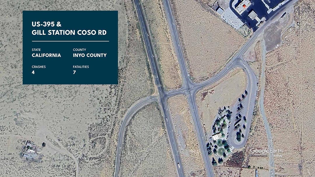
Eric Glenn // Shutterstock Intersections have long been dangerous spots for motorists, and this trend is particularly pronounced in the Western United States. From 2004 through 2022, over 35,000 people lost their lives in intersection-related crashes across the Western states–an average of nearly 2,000 fatalities each year. But which intersections are the deadliest? Where are drivers most at risk? Sam Aguiar Injury Lawyers analyzed data from the National Highway Traffic Safety Administration to find those answers. We examined every fatal crash from 2004 to 2022 to identify the intersections where the most fatal traffic collisions have occurred and to uncover patterns among them. Key Findings: Nine of the ten deadliest intersections in the Western U.S. are located in either Arizona (5) or California (4). The other is in Idaho. All five of the deadliest intersections in Arizona are found in Maricopa County, which includes Phoenix and its surrounding areas. 50% of fatal crashes occur at intersections controlled by stop signs, while only 6% occur at intersections with no traffic control devices. Nearly half of all fatal crashes occur at stop sign intersections, while only 6% occur at intersections with no control signals or signs. Fatal intersection-related crashes increased by nearly 50% in the Western U.S. from 2004 to 2022. A Surge in Fatal Crashes in the Western United States During the observation period, intersection-related fatal crashes increased in three out of four major U.S. regions. However, no region saw a sharper increase than the West. From 2004 to 2022, the total number of intersection-related crashes in the Western U.S. increased by 48%, with fatalities rising by 47% during the same period. The 10 Deadliest Intersections in the Western U.S. Sam Aguiar Injury Lawyers Below are the intersections where fatal crashes were most frequent during the observation period: BROADWAY ROAD and SR 85 (OGLESBY RD) Google Earth // Airbus Maricopa County, Arizona Traffic Control Device: Stop Sign Intersection Type: Four-Way Intersection Fatal Crashes: Six Fatalities: Seven 59TH AVE and INDIAN SCHOOL RD Google Earth // Landsat / Copernicus Maricopa County, Arizona Traffic Control Device: Traffic Light Intersection Type: Four-Way Intersection Fatal Crashes: Five Fatalities: Seven HAZEN RD and SR-85 (OGLESBY RD) Google Earth // Airbus Maricopa County, Arizona Traffic Control Device: Stop Sign Intersection Type: Four-Way Intersection Fatal Crashes: Five Fatalities: Seven SR-152 and VOLTA RD Google Earth // Landsat / Copernicus, Data LDEO-Columbia, NSF Merced County, California Traffic Control Device: Stop Sign Intersection Type: Four-Way Intersection Fatal Crashes: Five Fatalities: Six MARICOPA RD and SR-347 (N JOHN WAYNE PKWY) Google Earth // Landsat / Copernicus Maricopa County, Arizona Traffic Control Device: None Intersection Type: T-Intersection Fatal Crashes: Five Fatalities: Six US-95 and NEZ PERCE RD Google Earth // Airbus Nez Perce County, Idaho Traffic Control Device: Stop Sign Intersection Type: T-Intersection Fatal Crashes: Five Fatalities: Five IMPERIAL HWY and DOWNEY AVE Google Earth // Landsat / Copernicus, Airbus Los Angeles County, California Traffic Control Device: Traffic Light Intersection Type: Four-Way Intersection Fatal Crashes: Five Fatalities: Five CENTRAL AVE and 120TH ST Google Earth // Landsat / Copernicus, Airbus Los Angeles County, California Traffic Control Device: Traffic Light Intersection Type: Four-Way Intersection Fatal Crashes: Five Fatalities: Five RIGGS RD and SR-347 (N JOHN WAYNE PKWY) oogle Earth // Data SIO, NOAA, U.S. Navy Maricopa County, Arizona Traffic Control Device: Traffic Light Intersection Type: Four-Way Intersection Fatal Crashes: Five Fatalities: Five US-395 and GILL STATION COSO RD Google Earth // Airbus Inyo County, California Traffic Control Device: Stop Sign Intersection Type: Four-Way Intersection Fatal Crashes: Four Fatalities: Seven Data and Methodology This analysis was based on fatal crash data provided by the National Highway Traffic Safety Administration, or NHTSA, for the years 2004 through 2022. Only crashes flagged as “intersection-related” by the NHTSA were considered. The Western U.S. region, as defined by the Census Bureau, includes Alaska, Arizona, California, Colorado, Hawaii, Idaho, Montana, Nevada, New Mexico, Oregon, Utah, Washington, and Wyoming. This story was produced by Sam Aguiar Injury Lawyers and reviewed and distributed by Stacker.
The deadliest intersections in the Western United States
Oct 29, 2024 | 11:30 AM


